

Are you searching for the best hiking destinations in the US? Don’t worry, you won’t run out of them! Each state boasts natural spectacles that will surely treat your senses to the best of what Mother Nature can offer. Different regions in the United States offer an abundance of breathtaking natural sceneries perfect for a lovely day hike. Stunning alpine climbs, lush rainforests, mesmerizing canyons – take your pick!
Here, you will find a list of the most beautiful day hikes in America in no particular order. Our featured hikes range from easy to challenging, so pick the right trails for your hiking level and start adding them to your adventure bucket list!
Contents
10 Best Hiking Destinations in the US
Below are some of the best hiking areas in the US where you can have a fun time.
The Mist Trail
Location: Yosemite National Park, California
Distance: 7 miles
Yosemite’s signature trail offers hikers plenty of spectacular views throughout the hike. Rivers, waterfalls, and lush mixed forests greet you as you traverse this moderately strenuous trail. The entire trail journey offers an authentic experience you’ll only get from the best hiking destinations in the US.
Hike through the Mist Trail during springtime and you’ll experience enchanting views of the Vernal and Nevada Falls cascading down to the granite cliffs as the snow melts away. You can also go during the summer and autumn and get equally stunning waterfall views.
The trail starts at Happy Isles trailhead and follows the Merced River to the Vernal and Nevada Falls. You’ll reach Vernal Falls first, and then you can continue to Nevada Falls (the hike becomes more strenuous from here). Prepare to get soaking wet as you reach the bases of these two magnificent waterfalls.
Summary
| Trail Name | Mist Trail |
|---|---|
| Season | Spring, Summer, Autumn |
| Difficulty Level | Moderately Strenuous |
| Distance | 7 miles |
| Adventure Level | Authentic experience, Spectacular views, Waterfalls |
| Trail Highlights | Enchanting views of Vernal and Nevada Falls |
| Positives | Becomes more strenuous after Nevada Falls, Prepare to get soaking wet at waterfalls bases |
| Negatives | Strenuous sections may be challenging for some hikers |
Angel’s Landing
Location: Zion National Park, Utah
Distance: 5.4 miles
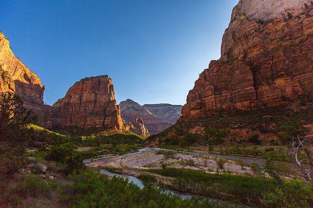

Angel’s Landing is a popular hike trail in Zion National Park, and with good reason. This thrilling and strenuous trail takes you through rock-scrambling sessions requiring the use of chains. You’ll also experience breathtaking views along the way.
The paved trail starts from The Grotto shuttle stop, crossing the Virgin River to reach the trailhead. You’ll then go uphill for the first two miles on the West Rim Trail. After that, you’ll pass by the shady Refrigerator Canyon, followed by Walter’s Wiggles, Scout Lookout, and the final climb to Angel’s Landing.
Note that the trail is for experienced hikers with no fear of heights. The trail could be fatal for those with insufficient hiking experience; a trip or fall could lead to injuries or even death. Thus this is one of the Best Hiking Destinations in the US, but it’s not for beginners.
Summary
| Trail Name | Angel’s Landing |
|---|---|
| Season | All Year (Avoid in Winter with Ice) |
| Difficulty Level | Strenuous |
| Distance | 5.4 miles |
| Adventure Level | Thrilling, Strenuous, Breathtaking Views |
| Trail Highlights | Rock-scrambling, Chains, Walter’s Wiggles |
| Positives | Breathtaking views, Thrilling experience |
| Negatives | Requires experience, Could be fatal for inexperienced hikers |
The Narrows
Location: Zion National Park, Utah
Distance: 3.6 miles
The Narrows joins the ranks of the best hiking destinations in the US. Situated also in Zion National Park, The Narrows is the perfect complement to Angel’s Landing hike.
The Narrows takes you down and deep into the Virgin River. It is the narrowest gorge section of the Zion Canyon. Hikers typically start their journey from the Temple of Sinawava via the Riverside Walk. The bottom-up hike continues by wading and walking upstream through the Virgin River.
As you tread through the river, you’ll experience spectacular views of the narrowest parts of the Zion Canyon. The main canyon’s majestic walls close in and form a tall, narrow canyon with shaded corners. The flowing Virgin River intensifies this pristine eye spectacle. All these make this spot one of the best hikes in the US.
Hikers are advised to journey through The Narrows on warm and dry days as the risks for danger are generally lower. The trail becomes dangerously fatal during bad weather days, with storms and rainfall bringing flashfloods that transform the Virgin River into a cascading and dangerous torrent.
Summary
| Trail Name | The Narrows |
|---|---|
| Season | Spring, Summer, Fall (Avoid during Rainy Seasons) |
| Difficulty Level | Moderate to Strenuous |
| Distance | 3.6 miles |
| Adventure Level | Spectacular, Adventurous, Scenic |
| Trail Highlights | Narrow Gorge, Virgin River, Majestic Walls |
| Positives | Spectacular views, Unique experience |
| Negatives | Weather-dependent, Risk of flash floods |
For a complete itinerary of Utah road trip destinations, check out our separate page with a comprehensive sampling.
Nugget Falls Trail
Location: Tongass National Forest, Juneau, Alaska
Distance: 2 miles
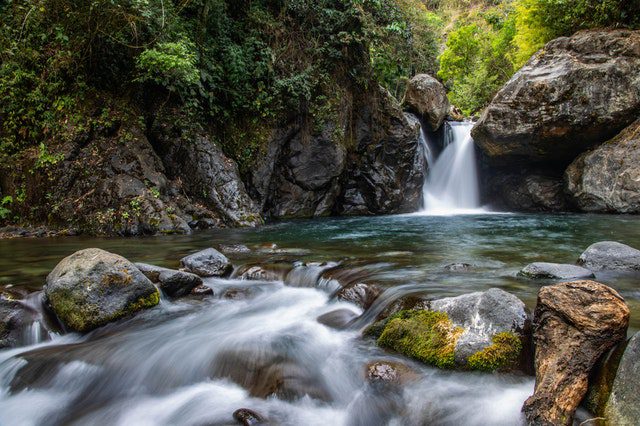

Here’s a light 2-mile Alaskan hike that will surely fill you up with wondrous natural spectacles. The Nugget Falls Trail is part of the East Glacier Loop and features breathtaking views of the Nugget Falls and Mendenhall Glacier’s blue ice terminus. It’s one of the best places to hike in the us thanks to its breathtaking views.
Your journey to the Nugget Falls Trail starts with the Mendenhall Glacier Visitor Center. The views from the Visitor Center are already magnificent to behold, prompting you to move forward to the trailhead at Photo Point. From there, you’ll hike an easy trail going over an elevated pathway until you reach the Nugget Falls.
Prepare to be blown away by the magnificent sightings you’ll see – tumbling waterfalls, lovely meadows, and a sparkling glacier terminus. You may even spot some black bear cubs, bald eagles, and sockeye salmon along the way! So if you are looking for places to hike and enjoy wildlife, this spot is a must-visit.
This trail also features of the top budget attractions in Alaska and if you want to know about more places in the nearby region, check out our dedicated sampling.
Summary
| Trail Name | Nugget Falls Trail |
|---|---|
| Season | Spring, Summer, Fall |
| Difficulty Level | Easy |
| Distance | 2 miles |
| Adventure Level | Scenic, Leisurely |
| Trail Highlights | Nugget Falls, Mendenhall Glacier, Wildlife |
| Positives | Breathtaking views, Easy accessibility |
| Negatives | May be crowded during peak seasons |
Charlies Bunion Hike
Location: Great Smoky Mountains National Park, Tennessee/North Carolina
Distance: 8.1 miles
Charlies Bunion Hike is among the best hiking destinations in the US, especially if you’re into panoramic views. The trail offers a majestic sight of the North Carolina Smokies, with several opportunities to see exquisite plants and wildflowers along the way. Prominent Smokies you’ll see include Mount Guyot to the east and Mt. Kephart and The Jump Off to the west.
The trail starts after you’ve unloaded from the Newfound Gap parking area. It follows the Appalachian Trail until you reach the Charlies Bunion rock outcropping. Along the way, you’ll enjoy majestic mountain sceneries, diverse plant life, and serene views.
Be warned – the Charlies Bunion Hike is rocky and steep. It’s a strenuous hike especially when you’re starting to inch closer to the Charlies Bunion itself. The trail has precipitous cliffs that require the utmost safety to prevent fatalities and accidents.
Your strenuous hike will ultimately be rewarded with a majestically serene view on top of the Charlies Bunion. It’s all worth it in the end!
Summary
| Trail Name | Charlies Bunion Hike |
|---|---|
| Season | Spring, Summer, Fall |
| Difficulty Level | Strenuous |
| Distance | 8.1 miles |
| Adventure Level | Scenic, Challenging |
| Trail Highlights | Mountain Scenery, Diverse Plant Life, Charlies Bunion |
| Positives | Majestic Views, Serene Environment |
| Negatives | Rocky and Steep Terrain, Precipitous Cliffs |
Burroughs Mountain Loop Trail
Location: Mount Rainier National Park, Washington
Distance: 6 miles to Second Burroughs, 9 miles to Third Burroughs
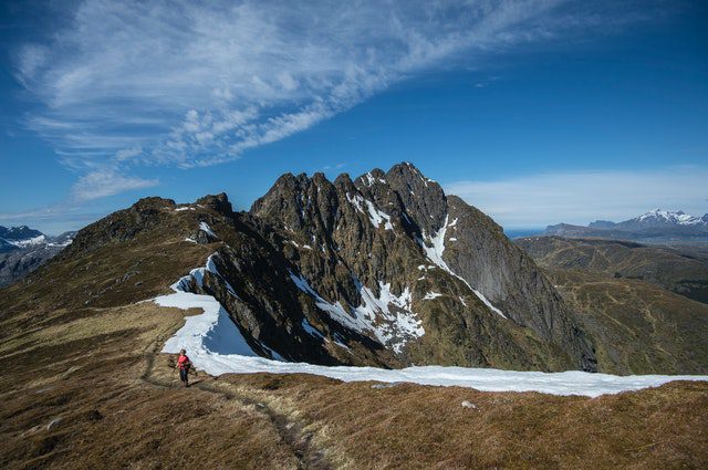

The Burroughs Mountain Loop Trail is among the most popular hikes from Mount Rainier National Park. The trail brings you a stunningly close view of the famed Mount Rainier and the alpine panorama. You’ll constantly see the scenic Washington Cascade and Mount Rainier’s eastern face. Wildlife such as goats, marmots, and occasional bears can be seen as well.
Hiking through the Burroughs Mountain Trail requires moderately strenuous skills – a bit challenging for amateur hikers but doable for experienced adventurers. Plenty of hikers can be seen up to the Sunrise Camp, but the crowd thins out from there until you reach the Third Burrough. It’s one of the popular spots for hiking tours.
Reward yourself with the absolutely breathtaking views from the Burroughs’ summit – Little Tahoma, the White River, and Emmons Glacier.
Summary
| Trail Name | Burroughs Mountain Loop Trail |
|---|---|
| Season | Summer, Fall |
| Difficulty Level | Moderately Strenuous |
| Distance | 6 miles to Second Burroughs, 9 miles to Third Burroughs |
| Adventure Level | Scenic, Challenging |
| Trail Highlights | Views of Mount Rainier, Alpine Panorama, Wildlife Sightings |
| Positives | Breathtaking Summit Views, Wildlife Encounters |
| Negatives | Challenging for Amateur Hikers, Crowded at Sunrise Camp |
Hoh River Trail
Location: Olympic National Park, Washington
Distance: 17.4 miles until Glacier Meadows
The Hoh River Trail in Washington features temperate rainforests and glacial rivers. It is a dreamy and serene sight to behold, considering that the trail on the Olympic National Park is among the last surviving temperate rainforests in America.
Hiking to the Hoh River starts from the Hoh Rainforest Visitor Center and ends at the Glacier Meadows. The trail stays relatively flat until you hike a little farther on the Lewis Meadows at 10.3 miles. From there, you’ll ascend to more than 3,000 feet as you journey through Lewis Meadow Camp, Elk Lake, and Glacier Meadows.
The Hoh River Trail is lined with plenty of moss, ferns, and old giant trees such as cedars, spruce, and firs. The light-to-moderate trail has seven campsites along the way, giving you lots of options to stay out in the woods for longer.
Summary
| Trail Name | Hoh River Trail |
|---|---|
| Season | Spring, Summer, Fall |
| Difficulty Level | Light-to-Moderate |
| Distance | 17.4 miles until Glacier Meadows |
| Adventure Level | Serene, Scenic |
| Trail Highlights | Temperate Rainforests, Glacial Rivers, Giant Trees |
| Positives | Beautiful Scenery, Seven Campsites |
| Negatives | Long Distance, Potential Crowds |
Chautauqua Trail
Location: Chautauqua Park, Boulder, Colorado
Distance: 1.5 miles
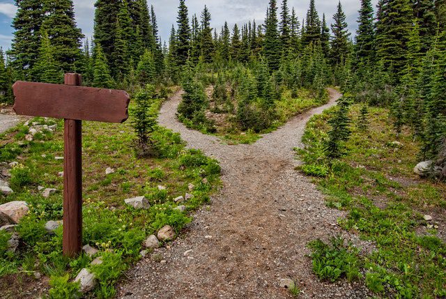

Chautauqua Trail is the most popular hiking trail in Boulder, Colorado. It leads to the famous slanting rock slabs of sandstone called The Flatirons. Chautauqua Trail is the starting point for accessing the following:
- Ski Jump Loop, going to the First and Second Flatirons
- Royal Arch Trail
- Enchanted Mesa
Apart from the Flatirons, you can also experience lovely views of Mount Sanitas, West Boulder, and parts of the Gregory Canyon. You’ll also get your fill of natural wonders as you hike along the way – Ponderosa pine trees, grassy meadows, and plenty of wildflowers.
The trail features quite a rocky and steep incline, so you’ll need to watch out for your footing. The difficulty level can be rated as moderate to aggressive. All the natural beauty you’ll see along the way is definitely worth the hike!
Summary
| Trail Name | Chautauqua Trail |
|---|---|
| Season | All Year |
| Difficulty Level | Moderate to Aggressive |
| Distance | 1.5 miles |
| Adventure Level | Scenic, Rocky Terrain |
| Trail Highlights | The Flatirons, Mount Sanitas, Wildflowers |
| Positives | Breathtaking Views, Variety of Scenery |
| Negatives | Rocky and Steep Incline |
Point Lobos Loop Trail
Location: Point Lobos State Natural Reserve, California
Distance: 6.7 miles
The lovely Pont Lobos Loop Trail is located in the south of California’s charming Carmel area. This trail will leave you in awe with its breathtaking ocean vistas and a picturesque view of the entire reserve. Point Lobos Loop Trail definitely belongs to the best hiking destinations in the US.
What makes the trail authentically lovely? It’s because of its status as a protected wild reserve, giving you access to untouched nature gleaming with pristine beauty. Crashing Pacific coast waves, awesome rock formations, deer, shorebirds, sea lions, sea otters, and abundant wildflowers await you on this exciting trail.
Hikers of any skill level are welcome to visit Point Lobos Loop Trail. It’s also a kid-friendly trail, so you can tag your family along with you. This spot is ideal for hiking trips with friends, family, and kids.
Summary
| Trail Name | Point Lobos Loop Trail |
|---|---|
| Season | All Year |
| Difficulty Level | Easy |
| Distance | 6.7 miles |
| Adventure Level | Scenic, Coastal |
| Trail Highlights | Ocean Vistas, Rock Formations, Wildlife, Wildflowers |
| Positives | Protected Reserve, Kid-Friendly, Breathtaking Views |
| Negatives | None significant |
Cascade Canyon Trail
Location: Grand Teton National Park, Wyoming
Distance: 9.3 miles
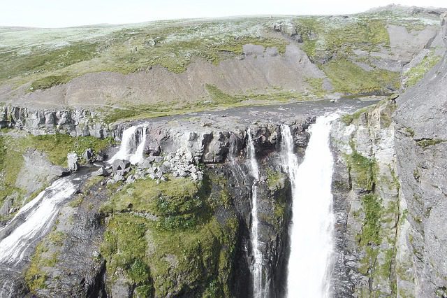

Cascade Canyon Trail rounds up our list of the most beautiful day hikes in America. This trail in Wyoming follows the Canyon Creek and will give you close access to plentiful wildlife, towering pine trees, waterfalls, rivers, and picturesque panoramic views. It’ll also give you a breathtaking view of the Grand Tetons since the trail leads up to its base.
The moderate-to-difficult hike commences on Jenny Lake and ends at a fork, taking you to Paintbrush Canyon. Expect both steep starts and ends for this hike. Be prepared with some bear spray, though – the area is home to several bears that come out, especially at night. This is one of the best places to hike if you love the thrill of wild animals paying you a visit now and then.
Overall, the Cascade Canyon Trail is moderately aggressive but all the views you’ll see along the way surely make it worth every hiking effort.
Summary
| Trail Name | Cascade Canyon Trail |
|---|---|
| Season | Summer, Fall |
| Difficulty Level | Moderate to Difficult |
| Distance | 9.3 miles |
| Adventure Level | Scenic, Wildlife |
| Trail Highlights | Pine Trees, Waterfalls, Rivers, Panoramic Views |
| Positives | Breathtaking Views, Wildlife Sightings |
| Negatives | Bear Activity, Steep Sections |
Tips Before Heading to the Best Hiking Destinations in the US
Here are a few tips you need to keep in mind before heading to the beautiful day hike trails in America:
- Leave no trace. Don’t leave your trash or disturb the environment in any way (like intentionally breaking branches).
- Be considerate of other hikers on the trail.
- Start your hike early to avoid crowded trails.
- Ensure that you have the right permits as needed, depending on the trail.
- Always check the weather before your hike. Consider calling the park first to find out if the trail is open before heading there.
- Keep a clear mind especially when encountering wild animals. Bring bear spray with you on trails that are known homes to bears.
Final words on Best Hiking Destinations in the US
We’ve listed the 10 best hiking destinations in the US. Find your pick and plan your breathtaking hiking vacations right now!
As part of your hike planning, you’ll need a trusty vacation rental property where you can stay before embarking on the hiking trail itself. It’s a good idea to check out Rental Trader so you can book accommodations before and after your hike.
Likewise, if you own a property near popular hiking destinations, you can list your site for interested hikers to find. In any case, please reach out to Rental Trader by walking through our simple listing process and show your vacation rental today.
Dust off your hiking boots now and plan your enjoyable next hike at any of the trails we’ve featured here!


